

Frequent heavy snow showers to continue to push inland across the north
Register for free to read more of the latest local news. It's easy and will only take a moment.

Throughout Wednesday frequent snow showers will continue to push inland across parts of Scotland and much of Northern Ireland, the heaviest snowfall will likely occur in hilly areas inland from the coastlines exposed to the north to north-westerly wind.
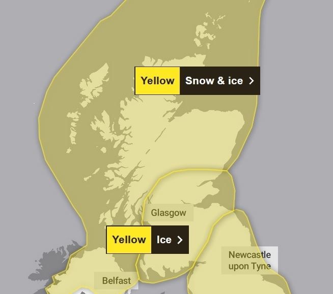
In these areas an additional 5-10cm of snow is likely, and there is the potential for a further 15-20cm of snow in a few locations during Wednesday (especially across Scotland).
Areas further inland from these most exposed regions are likely to see lower snowfall amounts, with perhaps a 1cm or so most probable here, with a chance of an isolated spot approaching 5cm.
Ice will be an additional hazard across the highlighted region.
On Thursday, further snow showers continue, but with the wind subtly changing to a more westerly direction, slightly different areas are most likely to see the greatest focus of showers compared to the previous day.
In many areas, this fresh snow will be falling on top of snow already on the ground.
Parts of northern and western Scotland (including southwest Scotland) are likely to see an additional 2-5cm fairly widely, with peaks of 15-20cm for areas just inland from west / northwest facing coasts.
Further inland towards the southeast of the area, an additional 1-2cm, with isolated 5cm is more probable.
In addition to the snowfall, ice is likely fairly widely, with thawing / re-freezing of slush and snow.