

Snow showers in the north and north-east set to continue through to Thursday
Register for free to read more of the latest local news. It's easy and will only take a moment.

Snow showers will continue to feed inland early on Tuesday morning across northern and western Scotland, parts of Wales and north-west England where 2-5cm of snow is possible over a few hours in some places.
A yellow warning has been issued by the Met Office as a result for Tuesday and Wednesday.
During the day, an area of more organised rain, sleet and snow is likely to move east with further showers following. There is still some uncertainty in the track of more prolonged snow, and it is possible that at lower elevations across Wales and northern England, this could turn to rain for a time.
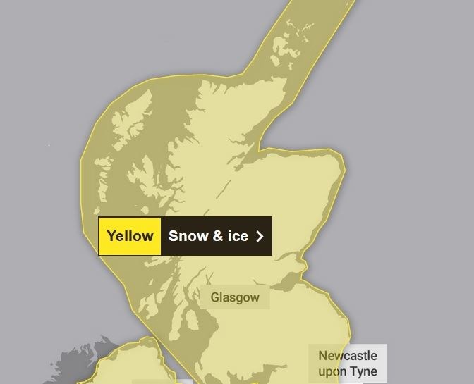
However, there is a chance some places could see 5-10cm perhaps 20cm of snow, particularly across the northern half of Scotland and over higher ground elsewhere.
In the following 24 hours, the heaviest and most frequent snow showers will be across northern Scotland during Wednesday morning, before developing across parts of southwest Scotland, Northern Ireland, north-west England and Wales later in the day.
Snow showers are likely to continue during Wednesday night and well into Thursday.
Whilst accumulations will vary due to the nature of showers, 2-5cm of snow is expected in many places.
Where showers become more organised, there is a chance some low-lying areas could see 10 cm in a few hours. Across northern Scotland over 20cm of snow could build up in a few locations.